
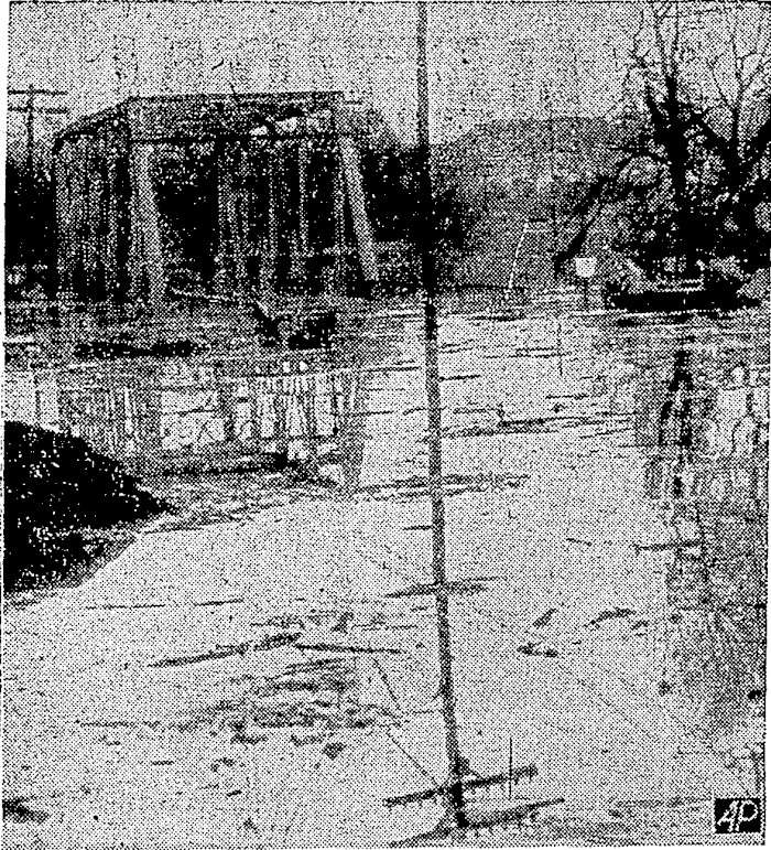
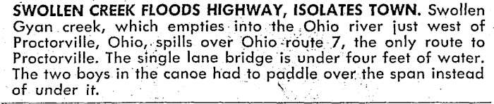
A newspaper photograph and caption describe floodwater covering the single-lane bridge over Guyan Creek near Proctorville. The caption reports that two boys in a canoe paddled over the submerged span.
Swollen Creek Floods Highway, Isolates Town
Source: Daily Illini, 17 February 1948, as cited in the supplied article; Illinois Digital Newspaper Collections.
Newspaper Caption
Swollen Creek Floods Highway, Isolates Town. Swollen Guyan Creek, which empties into the Ohio River just west of Proctorville, Ohio, spills over Ohio Route 7, the only route to Proctorville. The single-lane bridge is under four feet of water. The two boys in the canoe had to paddle over the span instead of under it.
Related Local History
- History of Proctorville, Ohio
- Bridges in Lawrence County, Ohio
- History of Chesapeake, Ohio — book contents
Editor’s Notes
The caption has been checked against the cropped newspaper image included with the uploaded article. Capitalization, hyphenation, and punctuation have been lightly standardized. The original caption identifies Guyan Creek just west of Proctorville; the previous webpage title placed the bridge “in Chesapeake,” while its URL referred to Symmes Creek. The title now follows the caption’s location rather than treating Indian Guyan Creek and Symmes Creek as the same waterway. The bridge’s precise historical location has not been independently established here.
The supplied source links to the Daily Illini issue of 17 February 1948 in the Illinois Digital Newspaper Collections. One image filename contains “1947,” but neither cropped image displays a date. The article retains 1948 as the cited publication year, pending verification of the full newspaper page. Publication date should not automatically be treated as the date the photograph was taken.
The four-foot water depth and description of Route 7 as “the only route” are statements from the contemporary caption. They describe the reported conditions at that time, not current roads or independently measured flood levels. The two boys are not named in the supplied material.
Local-history research presentation and editorial notes researched and written by Martha J. Martin. The newspaper photograph and caption are credited to their historical source and are not presented as her original reporting or photography.
Copyright © 2026 Martha J. Martin. All rights reserved for her original editorial writing and presentation of her research. The historical photograph and caption remain credited to their source; their reproduction rights have not been independently established. Written permission from Martha J. Martin is required to reproduce her original writing, except as permitted by law.