Since Chesapeake lies in Union Township, this first chapter will focus on its history.
Chapter One
|
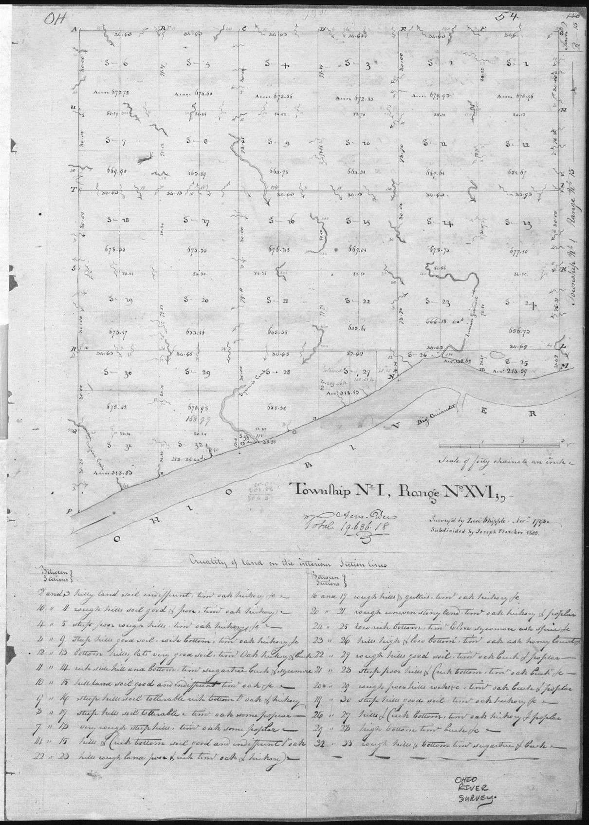
The above is the original Ohio River Survey Twp. 1, Range 16, Sections 1 – 33 |
Union Township, which would eventually become Ohio, was surveyed as part of a large region of Washington County, Territory, Northwest of the Ohio River. In 1803, Ohio became the 17th State admitted to the Union, and in the spring of that year, eight new counties were created, including Gallia County.
On 21 Dec. 1815, Lawrence County claimed all of Gallia County’s present-day townships except most of Rome Township. On 22 Dec. 1818, Lawrence County finally claimed the northern part of Rome Township, taken from Gallia County. This completed the newly formed Lawrence County, Ohio, including Union Township, where Chesapeake is currently located.
Union Township belonged to one of the early tracts of land known as Congress Lands. These lands were sold in parcels of varying sites directed by the government to individuals under rules and regulations laid down by Congress. [more about the Congress lands in a later chapter]
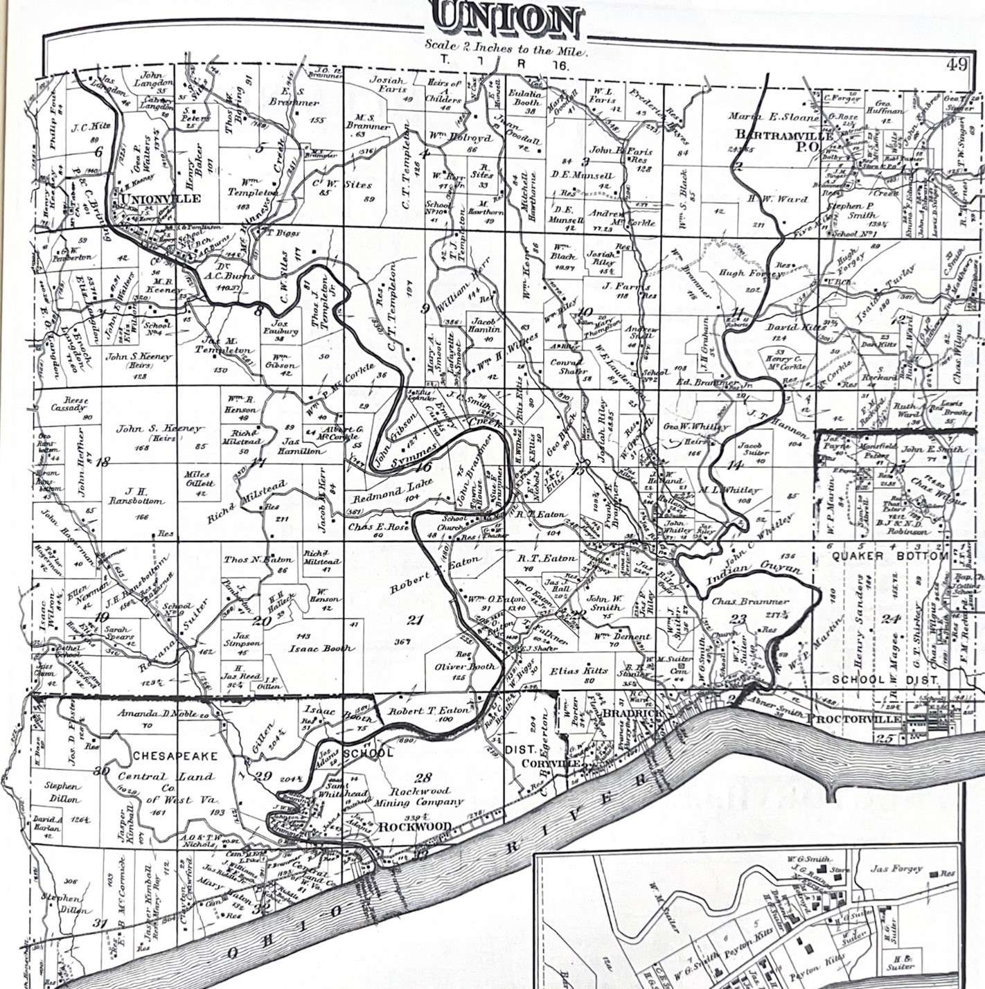
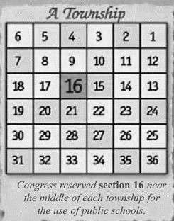
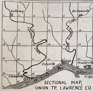
Union Township is one of the smaller townships in Lawrence County, Ohio. It should have contained 36 full Sections, each containing one square mile, equaling 640 acres. Instead, Union Township only has 33 Sections, and since Sections 25,25, 26, 27, 28, 31, 32, and 33 are along the Ohio River to the south, those Sections don’t have the required 640 acres. [see above photos]
Union Township has two large waterways covering the entire region, north to south, Symmes Creek and Indian Guyandotte Creek [the latter known as Indian Guyan].
Symmes Creek provided the best water and power and, doubtlessly, attracted the most citizens. Soon after early settlers claimed their property, they began to build homes and roadways. They soon used the water to develop grist, and other mills used to grind wheat, corn, and other commodities.
From a small colony of pioneers in Union Township, this region developed from a wilderness into one of the most important sections of Lawrence County, Ohio. Being along the Ohio River and other waterways was quite an advantage to the early settlers. As we progress through this online book, you will see how important this land was to them.
An interesting fact I need to introduce: The long hunters who were in Union Township before the Quakers arrived in 1797. The long hunters were hired by the early surveyors seeking to claim land for early land grants. Daniel Boone, a name we are all familiar with, was one of those long hunters.
Early Names in Union Township
Symmes Creek was named for Judge John Cleves Symmes, who was also a member of Congress. J. C. Symmes had cut his name on the bark of a beech tree, and the people finding his name there called it Symmes Creek. The first and only salt well from which salt was made was on Symmes Creek in Windsor Township, Section 31.
Buffalo Creek runs through Washington, Symmes, Union, and Fayette Townships. As legends spread of a large female buffalo being killed here (when buffalos were uncommon in this county), this area became known as “Buffalo Creek.”
Nearly opposite the mouth of Big Branch was Smith Point and Bottom. John Smith, a very early settler on this point, cleared the bottom.
Whitehead’s Branch was on the east side of Symmes Creek, named after Mr. Whitehead, who lived around there and owned a blacksmith shop at its mouth. The blacksmith shop was a favorite of the Grist Mill boys because Mr. Whitehead was always ready and willing to help them fix the Grist Mill anytime they needed repairs.
Wilson’s Branch was on the west side of Symmes Creek, and it was called Chinn Branch on the west fork. The surveyors called the whole creek Big Branch.
Union Township contains two incorporated municipalities – Proctorville [known as Quaker Bottom and settled by the Quakers in 1797] and Chesapeake – and four unincorporated villages, Bradrick, Coryville, Getaway, and Bartramsville. If you notice, all these areas have one thing in common: they are adjacent to water.
[Another quick note here: There are two separate communities named Coryville in Lawrence County, Ohio. One is in Upper Township, where Sacred Heart Cemetery is located, and the other is in Union Township, adjacent to the Ohio River and next to the small community named Bradrick. Sometimes, they are spelled Corryville and Coryville. – mjm]


0 Comments