Chesapeake was called many names
Chapter Two
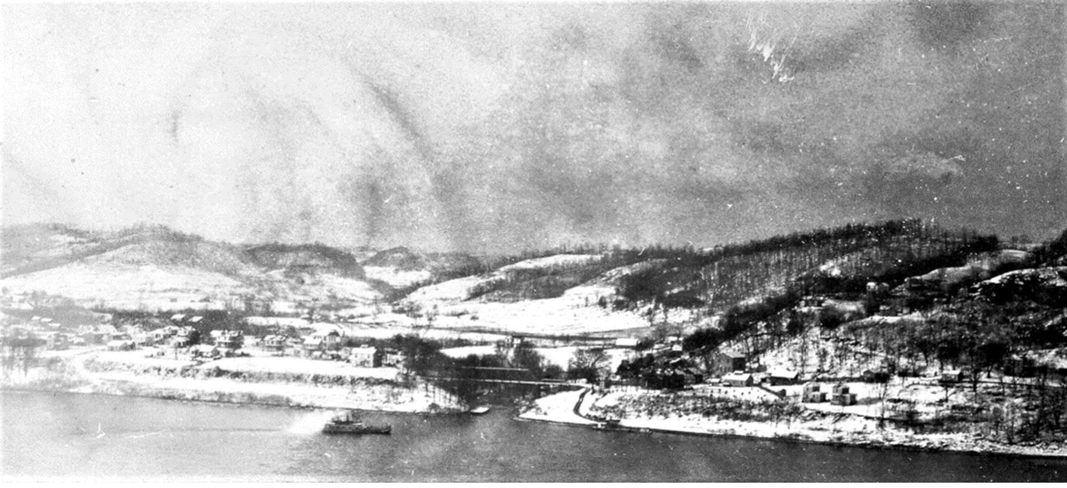
Isaacs, D. (1915). The above photo was retrieved from Facebook Group: Huntington WV You Grew Up In H-Town If… https://www.facebook.com/photo?fbid=4522072481150719&set=gm.2885255305031867
Chesapeake is one of the youngest villages in Lawrence County, but its beginning starts early in our county’s history. As we know it today, Chesapeake results from several settlements joining together.
Before it was named Chesapeake, this small community had several names: Washington, Frampton, Kounston, Symmes Run, Lawrenceburg, Lawrence City, Rockwood, and Flemingsburg, none officially recorded.
West Chesapeake and East Chesapeake
To understand the history of Chesapeake, think of it as two separate communities: Lawrence City [West] and Rockwood [East]. Early deeds and court records refer to these two names as what we now call “Chesapeake.”
For example, Kounston was only used in newspaper ads that A. P. Kouns ran trying to sell lots in the” town of Kounston.” I found one deed named Kounston when Andrew P. Kouns sold the property to the Chesapeake Board of Education in 1875. That property was the same land he had claimed as “Kounston.” Unfortunately, that name was never recorded. The local newspapers only ran his ads from around 1871 to 1873.
The early names of Frampton and Symmes Run were Post Office names. You may notice that many early Post Offices were named for the individual who owned the home or property where the early Post Office was located. Lawrenceburg was the name of the area where the end of the Chesapeake – Huntington Bridge is located.
The name Flemingsburg appears in the Lawrence County, Ohio, History Book, where John L. Jones wrote about Chesapeake without citing sources. There were also brief mentions in local newspapers. Flemings S. Booth probably submitted these articles to get his ‘community’ recognized as an official town.
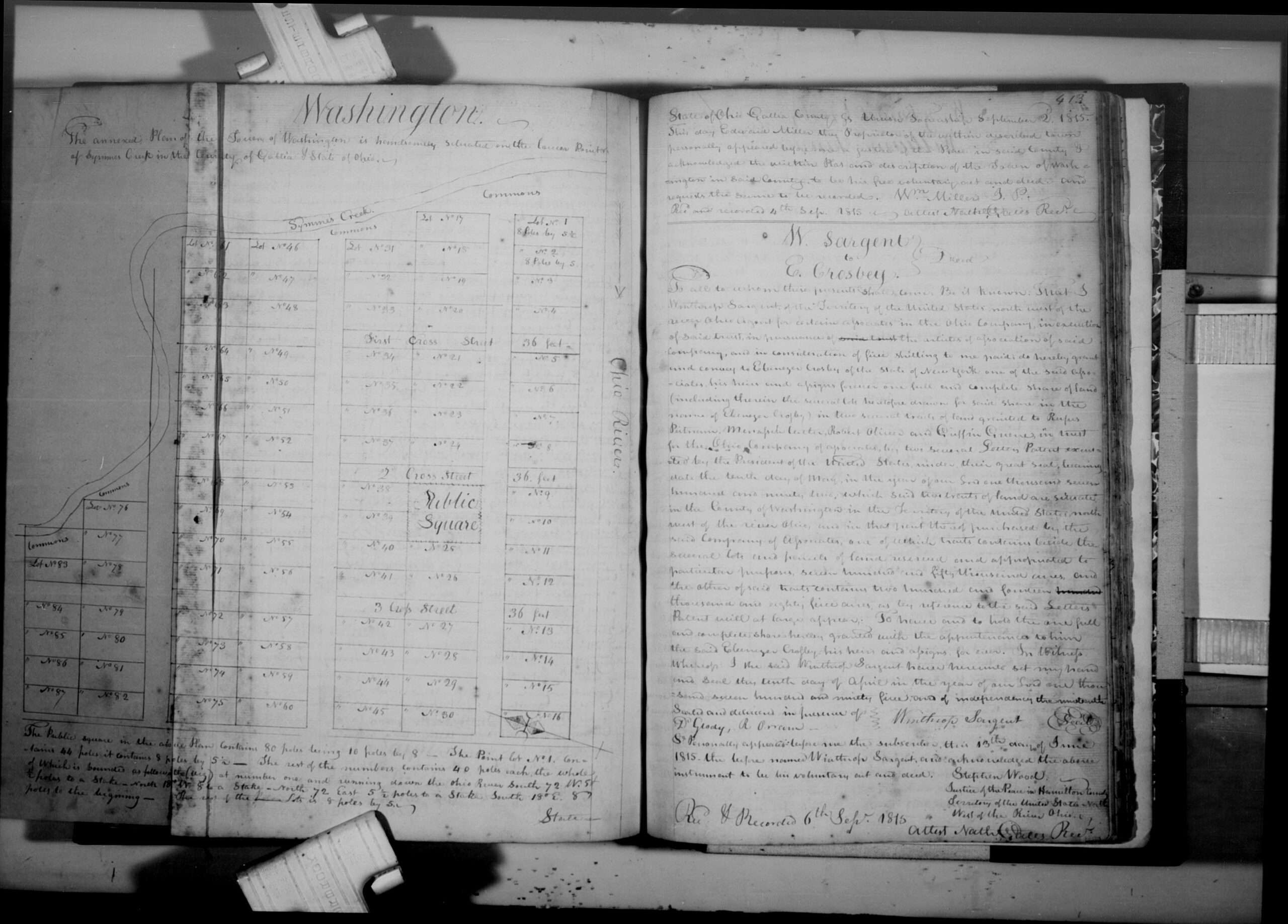
Washington [see below document] was another name for the area around Chesapeake.
Town of Washington
While reviewing some old records from Gallia County, Ohio, our “parent county,” I stumbled upon the original plat map drawn out for Edward Miller, called the “Town of Washington.” This is a copy of that plat map, [Gallia County, Ohio, Deed Book 5, pages 412-413] showing where it was located, which was at the forks of the Ohio River and Symmes Creek!
Edward had his “Town” surveyed and laid out into 87 lots!! This was in 1815, and Lawrence County did not become an “official” county until 22 Dec. 1818. The next chapter will be about Edward Miller and how he became the earliest landowner of what is now called Chesapeake.
| The transcription of the following deed was written exactly as it was written; it may have errors, so please read the deed and make your conclusions. I will be happy to correct any spelling errors if found. – mjmk |
Union Township, Gallia County, Ohio, Deed Book 5, pages 412-413, 2 Sep 1815
The annexed plan of the Town of Washington is handsomely situated on the lower point of Symmes Creek in the County of Gallia, State of Ohio.
The Public Square in the above Plan contains 80 poles being 10 poles by 8 – The Point lot No. 1 contains 44 poles it contains 8 poles by 5 1/2 – The rest of the numbers contain 40 poles each, the whole of which is bounded as follows, the (viz) At Number one and running down the Ohio River South, 72 W. 5 poles to a stake in North 18 degrees W. 8 to a stake – North 72 East 5 1/2 poles to a stake South 18 degrees E. 80? poles to the beginning – The reso of the — lots is 8 poles by 5
State
State of Ohio, Gallia County
Union Twp.
2 Sep 1815
This day, Edward Miller, the Proprietor of the within-described town, personally appeared before me, a J.P. in said county, and acknowledged the within Plat and description of the Town of Washington in said County to be his free voluntary act and deed and requested the same to be recorded.
Wm. Miller, JP
Recorded 4 Sep 1815

The above document can be found at FamilySearch.org, Court records, 1817-1856 film #8198783 , page 10, March Term 1818
The First Union Township Residents
as taken from 1820 U.S. Federal Census, typed as written
Richard Adams
Robert Adams
Edward Billips
John Billips
Margaret Blankenship
Daniel Booth
William Bracking
Edmund Brammer
Henry Brammer
John Brammer
Jona Cazey
Wm Chinn
Burill Coates
Margaret Cradle
Wm. Dunbar
Jos Duncan
Marvel Elkins
Wm. Ellis
John Ellisson
Wm Ellisson
John Ferris
Elisha Forgy
James Forgy
Barkamus French
John Fudge
Thomas Glover
Jona Grimes
Abraham Hall
Elisha Hall
Samuel Hall
Wm. Hanley
John Harrison
John Hillyard
Thomas Hillyard
John Hooper (age 103)
James Hovey
Lewis Howard
Wm. Howard
George Jackson
Tho R. Jones
Martin King
Wm. Kingery
Christian Koons
Daniel Laffoon
Samuel Langdon
John Martin
John McCorkle
Robert McCorkle
Robert McMan
Edward Miller
Jacob Miller
Wm. Miller
Randall Moore
John Morrisson
Henry Murphy
Polly Murphy
John Neal
Samuel Neal
John Jr. Overstreet
John Overstreet
George Pine
David Porter
Sally Pratt
Wm. Pusee
Jos. Riley
Isam Roley
Joel Roley
John Scott
John Sharp
Richard Sharp
Augustus Smith
Samuel Smith
Jacob Sryock
Jerah Stephenson
Jerh Stephenson
Zack Stephenson
Philip Suiter
Wm. Suiter
Richard Sumpter
James Templeton
John Templeton
Thomas Templeton
Abraham Tier
John Tier
Jer. Wade
Frances Wilks
James Wilks
James Wilson
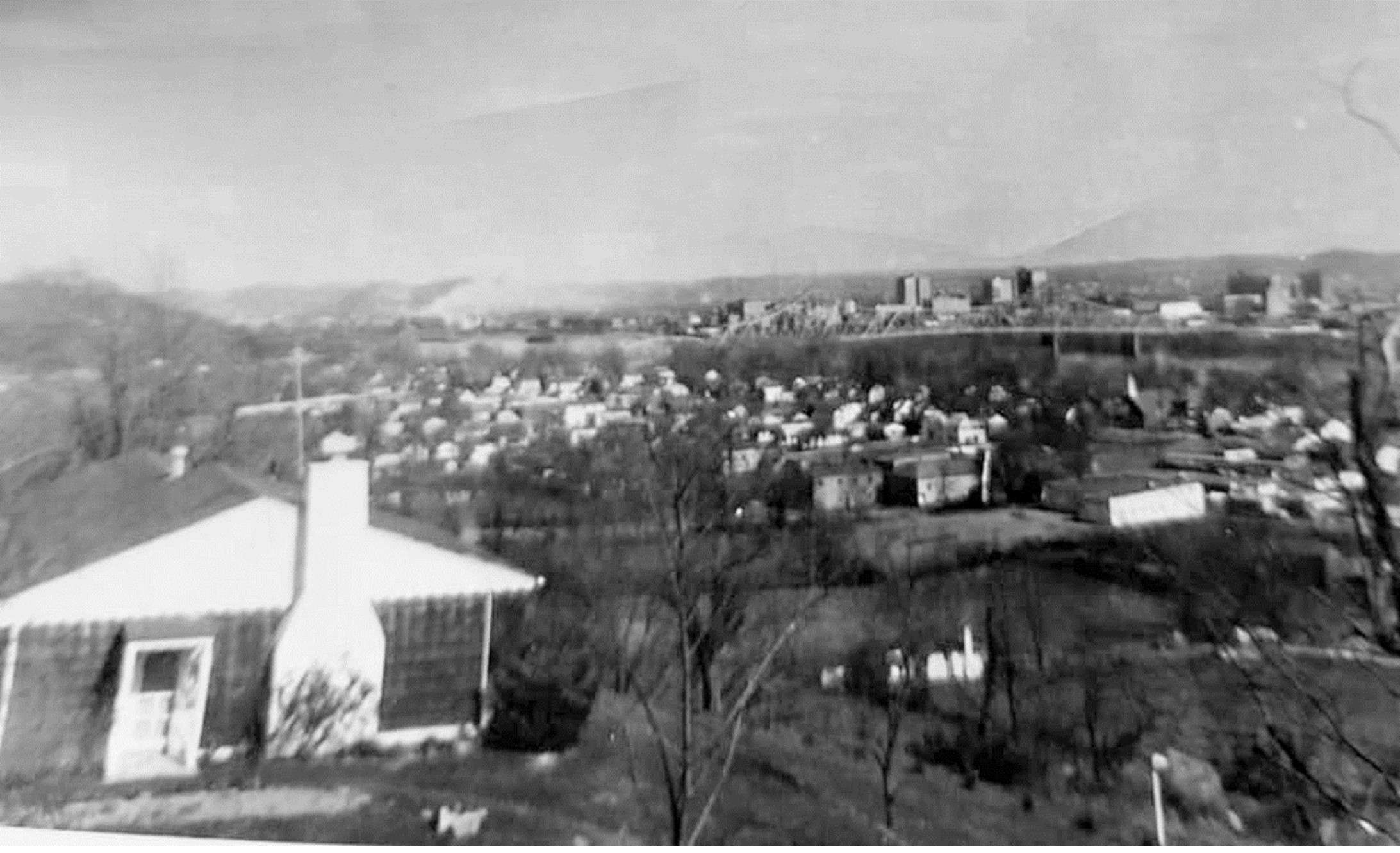
Welton, D. (2019). The above photo was retrieved from the Facebook Group: Vintage Chesapeake Proctorville South Point. https://www.facebook.com/photo/?fbid=1388891797915302&set=g.381004402439103


0 Comments